Happy Birthday to the birthday boy! At Northwind Marina, there is a lively little cafe, where we had hoped to have a birthday breakfast. We dawdled for too long though, and when we got up there, the line was out the door. Rather than wait and miss our opportunity to slip out on high water, we decided to eat aboard. I cooked a nice omelet with potatoes, tomatoes, peppers, mushrooms, and cheddar. Norm is a good sport, and did the dishes We made tuna sandwiches to store for lunch later in the day.
[Norm] Fueled at Sesuit and departed harbor 11:30. Channel plenty deep but we were cautious.
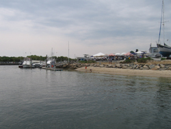
We took pictures of the folks on shore and the breakwater once we were clear.
Safely out in Mass Bay again, we set our course for Ptown. We sailed across, the first "sea"mark being Billinsgate Island. That was the first I have ever heard of Billingsgate, although I have read many histories of the area. I'm sure it is mentioned but sometimes things don't register until you see them with different eyes. We sailed past the buoy, and I was just amazed that there is a sunken island in the bay.
[Norm] Nice beat to Ptown in under 10kts East.
15:00 Sail around Ptown harbor, departed 16:00. E oogling all her old haunts "When I was here with the kids...."
17:00 G"1" off Wood End Point
17:30 kite up. Rolling along at 6kts. Rain on horizon ahead. Wind S at 10kts.
Cape scene is pretty - dunes, grass, lighthouses, frolicking folk. Tuna sandwiches, tea.
[Norm] 22:30 Off Minot's light. Heading 300° for Boston Light. 6+kts.
Kite is up, wind under 15, sometimes very shifty. Gybed twice, once off Scituate and just now.
Beautiful sailing. Visible is the offshore platform construction. Lots of lights - crane boom, all lit up - looks like a sci-fi monster eating its way into Boston.
Few vessels out here. Chilly quiet. Suspect many yachts in their vacation harbors. We are home early, instead of beating home in Monday's predicted NW.
Averisera scoots along in the gentle seas and wind nicely. Making tea water - no gimbaling required.
E has been driving most of the day. Learning to sail the boat. N learning to relax and enjoy a great sail.
Another midnight arrival in the Narrows planned. Night sailing pleases us both. Safety harness and foul weather gear, cool but not cold.
[E] 23:51 Pt. Allerton buoy. 22 hrs, 110 nautical miles. VMG 5nm/hr.
We could almost swim faster. Not really.
Norm is tired. The birthday boy has had a big weekend. Weather is starting to be visible in the west, behind the cityscape. Will we make it without getting rained on?
Stay tuned.
Motoring 5+kts. Wind had died down and come way forward, so we dropped the kite and turned on the engine.
We tucked into our slip at Constitution Marina around 2am, put the boat away, and headed home. We only saw a few raindrops here as we made our way into Boston. The rainstorm never did materialize on Monday. But we were not disappointed, that we didn't sail on Monday. We spent the day regrouping, doing laundry, and cleaning up the boat.
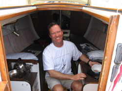 | Norm had his birthday while we were in Dennis. We couldn't get into the cafe at the Marina, the line was too long. So we made breakfast aboard. Even though it was his birthday, he still gets to clean up. |
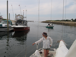
[Norm] Fueled at Sesuit and departed harbor 11:30. Channel plenty deep but we were cautious.
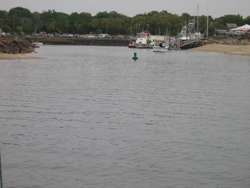
We took pictures of the folks on shore and the breakwater once we were clear.
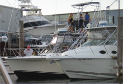
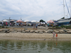 | Folks having breakfast at the cafe found our departure interesting enough to watch |
 | We fueled up just before we left. It is deep around the fuel dock, but watch how you depart. Move right over to the middle of the channel. |
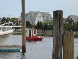
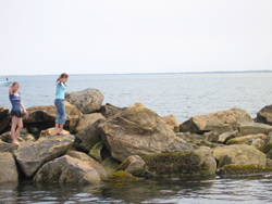 | Two youngsters on the breakwater, wave goodbye as we cautiously make our way out |
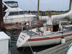
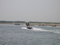
 | Safely out without running aground, you can see the relief on my face |
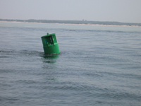
Safely out in Mass Bay again, we set our course for Ptown. We sailed across, the first "sea"mark being Billinsgate Island. That was the first I have ever heard of Billingsgate, although I have read many histories of the area. I'm sure it is mentioned but sometimes things don't register until you see them with different eyes. We sailed past the buoy, and I was just amazed that there is a sunken island in the bay.
[Norm] Nice beat to Ptown in under 10kts East.
15:00 Sail around Ptown harbor, departed 16:00. E oogling all her old haunts "When I was here with the kids...."
17:00 G"1" off Wood End Point
17:30 kite up. Rolling along at 6kts. Rain on horizon ahead. Wind S at 10kts.
Cape scene is pretty - dunes, grass, lighthouses, frolicking folk. Tuna sandwiches, tea.
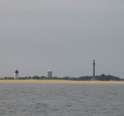 | Here we are approaching the wrist of Ptown. Race Point Light, the water tower, and Pilgrim Monument are all lined up |
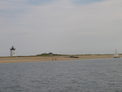 | Just inside the curved fist of Ptown, there is a nice beach on Race Point. It's a long walk over the breakwater, but a quick sail across the harbor. |
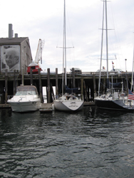 | 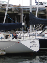 |
| Fisherman's Wharf in Ptown. Wait a minute, I recognize that boat! | Melina from Boston Sailing Center is tied up here! Wut? |
[Norm] 22:30 Off Minot's light. Heading 300° for Boston Light. 6+kts.
Kite is up, wind under 15, sometimes very shifty. Gybed twice, once off Scituate and just now.
Beautiful sailing. Visible is the offshore platform construction. Lots of lights - crane boom, all lit up - looks like a sci-fi monster eating its way into Boston.
Few vessels out here. Chilly quiet. Suspect many yachts in their vacation harbors. We are home early, instead of beating home in Monday's predicted NW.
Averisera scoots along in the gentle seas and wind nicely. Making tea water - no gimbaling required.
E has been driving most of the day. Learning to sail the boat. N learning to relax and enjoy a great sail.
Another midnight arrival in the Narrows planned. Night sailing pleases us both. Safety harness and foul weather gear, cool but not cold.
[E] 23:51 Pt. Allerton buoy. 22 hrs, 110 nautical miles. VMG 5nm/hr.
We could almost swim faster. Not really.
Norm is tired. The birthday boy has had a big weekend. Weather is starting to be visible in the west, behind the cityscape. Will we make it without getting rained on?
Stay tuned.
Motoring 5+kts. Wind had died down and come way forward, so we dropped the kite and turned on the engine.
We tucked into our slip at Constitution Marina around 2am, put the boat away, and headed home. We only saw a few raindrops here as we made our way into Boston. The rainstorm never did materialize on Monday. But we were not disappointed, that we didn't sail on Monday. We spent the day regrouping, doing laundry, and cleaning up the boat.